Showing posts with label Bike Rides. Show all posts

Tuesday, July 28, 2009

A Beautiful Governor

July 24, 2009

And by that I mean a beautiful island. Namely, Governors Island which sits, serenely, off the bottom tip of another island, Manhattan. An island so named, because when the Brits took over from the Dutch in 1674 (after a 10-year period of back-and-forth control), they did so for the “benefit and accommodation of His Majesty's Governors.” Never mind for the benefit of the original people who lived in the area - the Native Americans of Manahatas. The Dutch, efficient (and greedy) businessman that they were, had already purchased the island (which the Native Americans called Pagganck) for "two ax heads, a string of beads, and a handful of nails." It wasn't until 110 years later in 1784, however, that the island officially received its current name: Governors Island. Over the years, the isle served a mostly military purpose. Given its strategic location, forts were built that served to keep the British from even attempting to take New York during the War of 1812. If you're interested in more history than that you can go to the Island's website here.

Now for the real purpose of this post. Wow! This is a fabulous place! It's one of our city's new parks that will offer one a fantastic view and appreciation of our grand and magnificent harbor. Open Fridays and weekends form May 30th to October 11th , one can board a free ferry at the foot of Whitehall Street (just east of the Staten Island Ferry terminal ). You can board the ferry on foot or on bike but, happily, not by car. And you can rent a bike or a 4-wheeled bike-buggy on the island. On Fridays, bike rentals are even free but get there early as they go fast.

This place is a magical gem with a new and spectacular view at every turn in the road that one uses to circumnavigate the island. Here there are concerts, a sand "beach" (no swimming), free kayaks, art exhibits, cafes and food concessions and the most marvelous picnic locations, complete with sprawling lawns, lovely old shade trees, tables, benches and glorious hammocks! Then again, you can picnic in Nolan Park in the center of the island. A lovely oasis of towering London plane trees on each side of the center common are bordered with 19th century Victorian frame houses, used by the officers who inhabited this place once upon a time. Set up your picnic right on one of the porches and relax in the shade of the trees. If you want to avoid crazy crowds, you're probably better off on a Friday than a weekend.

Stacey and I started out on Friday morning. We mounted our bikes and headed for the Brooklyn Bridge, about three miles from our home in Prospect Heights. Though we've ridden over the bridge countless times, it's still a thrill. The views of lower Manhattan, the East River, the poetic structure of the bridge itself are always inspring.

(Note: You can click on any photo to see it larger). Stacey leads the way as we biked across the Brooklyn Bridge - awe-inspiring visit in its own right. Destination - Governors Island.

Biking the Brooklyn Bridge is a trip back to the late 1800's - a gargantuan stone structure that has stood the test of time. Just a few years later, the Williamsburg Bridge was constructed all of steel.

Midway across the bridge we stop to view our destination - that verdant island on the horizon in the middle of the harbor The large construction site just below is a future section of the miles-long Brooklyn Bridge Park that is being built along the East River.

We biked down Broadway and reached the ferry which is free and runs every hour on the hour (island bound).

"All 'board!"

"Are there sharks in the water? Can you ride a bike over there? Where are the bikes? What would happen if we fell in the water here?" And a hundred other questions.

A view off the port side of the ferry with a view up the East River to the Brooklyn, Manhattan and Williamsburg Bridges.

Leaving Manhattan behind.

When you finish the short ferry ride and exit the ferry, it feels a bit like you're immigrants, newly-arrived at Ellis Island. People pour off the boat, on foot and bike, and look around, puzzled about what to do and where to go. Maps are available and friendly staff are all about to answer your queries.

"OK, we're here. Now what?"

After a stop in the bathroom, Stacey and I set off to explore the island. A bike path beckoned to the left and off we went. This appeared to be the circumferential road. We wanted to make a loop - several miles around - to see the views it afforded. Then we'd check out a bit of the island's interior. The park is still a work in progress - much of it is off bounds as old Coast Guard buildings and facilities are renovated and made accessible to the public. But already the park incorporates a large expanse of recreational space including the 2.2 mile "Great Promenade" which we were setting off on our bikes.

A view across the harbor and up the East River. Benches and picnc spots abound on the Great Promenade that rings the island.

Say, that's cool! These 4-wheeled, 4-person bike buggies are for rent - free on Fridays - for those of you who don't know how to balance on two wheels.

You're in for a treat when you come around the southern tip of the island. (Remember to click any photo for a larger version).

As we continue around the island, an awesome view of Manhattan.


Stacey rounds the northwest corner of the island at Castle Williams which protected the city from British invasion in 1812.

We finished our ride with an brief exploration of the center of the island. Here we discovered more charm: Colonel's Row and Nolan's Park - both lined with 19th century officers' homes and the Parade Grounds, a vast expanse of lawn. There's also a public school that served the children of Coast Guard service personnel and a movie theater that was showing a scary summer thriller. All these are free for you to enter and explore.

Colonel's Row, in the center of the island, with tree-shaded walkways, beautiful old houses and plenty of room for picnics or exploring.

Whoa! A giant ship appears and docks across Buttermilk Channel in Brooklyn. The scale and scope of the harbor is enormous when viewed from this location.

We stopped at the Water Taxi sand beach (one of several throughout the city). This is equipped with, yes, sand and picnic tables. Adjacent is a hot dog stand where we stopped for a frank and a ice cold one before boarding the ferry back to Manhattan.

Nolan Park, surrounded by 19th century homes. One can sit on a porch and relax of have a picnic.

The Water Taxi sand "beach," with picnic tables, food concession and a palm tree.

It was a perfect few hours. The day had threatened rain with ominous clouds as we started out but, as seems to happen lately, had turned into a clear blue sky with puffy white clouds. We promised to return to explore some more. This is a great NYC destination that you should put on the top of your list for things to do and see in our city. See you on the bike path! - Matt

P.S. To see all my photos of Governors Island, click here for a SLIDE SHOW or here to visit the PHOTO GALLERY.

Tuesday, September 02, 2008

A Bike Ride To The Battery - Courtesy Of IKEA.

Sep 2, 2008

A new park has risen in Brooklyn. But unlike the old days when parks were the creations of cities and governments on behalf of their citizens, this park comes to our borough on the back of private enterprise. Ikea, the giant furniture chain, has come to Brooklyn and put itself down on the edge of the harbor. Ikea has placed its enormous blue and yellow box on land that once fronted the largest man-made harbor in the country, the Erie Basin. Since the demise of the historic and once-bustling Brooklyn waterfront, that land and the piers and structures that lined its shores entered a long period of decay. Abandoned by the ships that once carried grain and product from American farms and factories to the markets of Europe and beyond, the Brooklyn waterfront became a decrepit and crumbling shoreline, devoid of activity. Hulking wrecks of piers and warehouses have, for decades now, lined its once-proud shores. Neighborhoods died as well, inhabited only by the poorest of the poor.

Now Brooklyn is undergoing a massive renaissance as vast swathes of its territory are transformed (perhapds "demolished" is a more accurate term) and replaced with luxury condos and hi-rise apartment houses for upper income folk. Manhattan has beoam the borough for the very wealthy set and so waves of people have moved across the river to more "affordable" locales. And the developers saw dollars to be made. Thus does Ikea come to down-and-out-for-decades Red Hook.

It's a commentary on 30 tragic years of conservative rule that new parks today have to be given to us by corporations (as a payback of sorts for very generous tax breaks from City Hall). But with three trillion dollar wars, cities don't have money for such things as waterfront parks (or schools or public hospitals for that matter) as tax dollars have taken a one-way trip to the Pentagon and war-profiting corporations. A recent article in the New York Times documented that fact. In a portrait of New Haven, the reporter showed that many localities now depend on wealthy corporations to undertake major improvements to their cities. In New Haven it's Yale. In New York it's Ikea. But the trend is clear and it's called privatization. The question is - who's calling the tune and deciding what gets built and where? When its corporate money you can be sure that there are interests beyond those of the public that hold sway. So it is with waterfront parks and so it is with un-needed stadiums and sun-blocking high rises in the backyard of beautful and historic brownstone communities.

However, a beautiful park it is. Ikea has done a great job - a pedestrian/bike path wanders about a mile or so along the Red Hook waterfront. Signs explain the history of this once-busy port as a massive parking lot now lies where once giant shipyards stood. Here and there they have left standing some of the detritus of a former civilization - giant cranes hover overhead, painted a dull but dramatic navy gray; giant gears and mechanisms from some sort of portside machinery lie frozen in time below them. Maritime grasses and lovely flowers have been planted in abundance and in Ikea's spare and modern style, benches and chairs are placed along the length of the promenade. The view - a fabulous panorama of New York harbor - Governor's Island, the distant Port of Newark (that helped kill the Brooklyn ports), the Statue of Liberty and the Manhattan skyline all compete for your attention. And by the way, this has to be the greatest sunset viewing location in all of Brooklyn!

And the fantatic kicker to all this is that you can bike out to Red Hook and then board, gratis, a NYC Water Taxi for a trip across the harbor to Wall Street. Bikes are welcome on board and you don't even have to shop at Ikea!

So on a beautiful end-of-summer Tuesday, my friend Ed and I pedaled over the Ikea for a free taxi ride to Manhattan.

Ed calls for me and we set off for Red Hook by bike.

Red Hook is separated from Carroll Gardens and Cobble Hill by the giant, hulking Gowanus Expressway.

Wow - what a view. Prime waterfront land for a furniture store. Hey! But we got a nice park out of it, right?

Fabulous views of our city's harbor abound. Here, old cranes from yesteryear are hover above you as the promenade wends its way along the old port. In the distance, the Statue of Liberty.

The ferry boards at Ikea and takes you to lower Manhattan.

The ride across the harbor is breathtaking. As you leave the shelter of Erie Basin, views of the remote Manhattan skyline stand in contrast to the rotting decay of the abandoned piers and structures of the Brooklyn waterfront. Then, quickly, you pass Governor's Island, the Statue of Liberty, and Downtown Brooklyn with its new high rises. Approaching the Wall Street pier where we would debark, other boats pass by and helicopters hover overhead and lower New York's gleaming skyscrapers tower above set off against a brilliant blue sky. Further up the East River, the Brooklyn Bridge spans the horizon and I thought that this is truly one of the great panoramas to be enjoyed anywhere.

Leaving Brooklyn, the Manhattan skyline competes with the rotting decay of Brooklyn's moribune waterfront.

There's the statue!

Fabulous views of Brooklyn, Manhattan and New Jersey!

We pass some of the last few working piers on Brooklyn's waterfront - a shadow of their former self.

A good opportunity for photos.

Looking up the East River - the Brooklyn Bridge and the Manhattan Bridge beyond it.

We reach our destination - the Wall Street pier and lower Manhattan.

Monday, June 02, 2008

Pedaling For Peace - A Great Bike Ride (And A Wet One)

Jun 2, 2008

This past Saturday, dozens of intrepid cyclists set out from NYC's Central Park. They were biking to raise funds for the NYC section of United for Peace and Justice, a national coalition of organizations fighting to end the war on Iraq and other issues of foreign and domestic policy. This was the second annual Pedal for Peace bike ride.

The turnout was smaller than expected due to dire predictions of heavy rains. And we did get poured on but, fortunately, not till the end of the ride. Still, the spirit of the riders was high and the dedication to the cause of peace, indefatigable. In the end, we raised $4,000 for our favorite cause: peace. And we had a fun-filled and rewarding bike ride.

Stacey mounts her bike at our house in Brooklyn at 9:30. We're setting off for Prospect Perk, our local coffee shop where' we'll meet friends and board the subway to Manhattan.

It was a cloudy day as we awoke Saturday morning and got ready to leave for Manhattan. The overcast skies did not bode well for a bike ride. But at least it wasn't raining and we hoped that the showers would at least hold off until after we were finished. We met our friend Roque at Prospect Perk, our local coffee shop, and then hopped onto the Q train where we met up with another friend, Sam and his son, Noah. We took the train to 57th Street and rode the 3 miles or so up through the park to the starting point: 110th Street and Adam Clayton Powell Boulevard.

Arriving at the starting point we found other bikers with their distinctive yellow t-shirts and lots of volunteers to check us in and cheer us on.

Out friends, Noah and his dad, Sam. They're ready to ride.

The riders were chafing at the bit, wanting to get under way and beat the raindrops. But first, some pointers and tips from Leslie Kielson of NYC-UFPJ. She reported on upcoming actions to end the war that the group was planning. Next the head marshall for the ride gave us advice on how to ride safely and what to do in the event of a problem or accident.

Finally, we were off. Up we rode through Harlem, a stream of yellow-shirted bike riders. Chanting (or in my case, bellowing) peace slogans demanding an end to the war in Iraq, the swift return of the troops and the reversal of priorities away from war and to meet people's needs, we were met with enthusiastic greeting from people out shopping or hanging out on their stoops. Many flashed us the V sign. Others cheered or applauded. It was very exciting and exhilarating.

This was a family ride with lots of young bikers for global justice and peace.

Bikes had peace signs mounted on them - people on the streets greeted the bikers with enthusiastic support.

Here's a great sight -- An entire family pedaling for peace.

Leslie Kielson, of UFPJ-NYC, gives a last minute pep talk before we pedal on out of Central Park.

We're off! At 11 o'clock the riders left Central Park and headed up through Harlem.

The view in my rear view mirror.

"We're riding today against the war in Iraq - to bring the troops home and to bring the money home!" People responded with applause and v-signs.

Heading up the very steep Macombs Dam bridge ramp.


The route took us through Harlem and then El Barrio where some of the riders shouted out "¡Fin a la guerra!" (End the war!)Again, folks on the street shouted back their support. Now we knew first hand what the polls meant when they said 70% of the American people hate this war and want it over. From my vantage point, on top my bike, it seemed like it was over 90% but that's not a scientific poll, is it?

After a while of huffing and puffing and a long upgrade near the very pretty Macombs Dam bridge (that leads to Yankee Stadium) we reached our destination - High Bridge Park in upper Manhattan at 168th Street. The High Bridge is NYC's oldest standing bridge and was built in 1848 to carry fresh drinking water from upstate to New York. The view from the elevated park is awesome and you can see clear across the Harlem River below and out across The Bronx.

Our rest stop at High Bridge park in upper Manhattan. Awesome views across The Bronx and beyond.

Bikers at our rest stop with the High Bridge Tower in the background.

Looking out from High Bridge park across The Bronx.


After being served sandwiches, apples and health bars we were ready for a nap but the rain began. It was a few drops at first but then a bit heavier. But we had quite a few miles to get back to our starting point. So we mounted our trusty steeds and headed back south. The rain came down harder and harder. But, we figured, once you're wet, you're wet. We adjusted our speed downwards (for saftey's sake) and had lots of fun as we finally reached Central Park again. The rain had soaked us but it not dampened our enthusiasm for what was a wonderful bike ride with a lofty purpose. We're all looking forward to the third annual ride next year and hoping it will be a bit sunnier and, yes, drier.

We rode through a pouring rain on our way back - but the spirit remained high as we returned to our starting point in Central Park.

For a slide show of all my photos, click here.

Friday, November 04, 2005

A Bike Ride Back In Time

Nov 4, 2005

Blue Ball.
Intercourse.
Bird In Hand.
Lititz!

No, this is not some sort of torrid post about late middle-aged sexual adventures. These are some of the quaint town names in the Amish farm country of Pennsylvania. Some weeks ago in the Times, I read an article in the Escapes section -
Amish Country Over the Handlebar. I called Bob Heisler, my old friend from Camp Kinderland days and, like me, an avid bike rider. Had he read the article, I asked. And I thought that was the end of it. I never thought that Bob and I and a third, new-found friend, Fred Reichman, would actually plan and embark on a mid-week jaunt to Lancaster and environs.

And why not? The weather forecasts were predicting unusual-for-late-October 60 degree temperatures and sunny days. The fall foliage had not quite reached as far south as southern Pennsylvania so it looked like it would be perfect for our arrival. Bob made a motel reservation at a Best Western, we downloaded ride sheets from the
Lancaster Bike Club and planned our escape from New York for Wednesday and Thursday.

The guys took their bikes and packs on the subway and met at my house where we packed up the Honda van and headed out of the city at about 8:30 on Wednesday morning. The day was glorious, if a bit too windy, as we sped down the Jersey Tunpike connecting eventually to the Pennsylvania Turnpike. On route we perused the various ride sheets and decided on one humorously dubbed The Boisterous Cloister Clomp. This was a "B" ride - not as hard as an "A" ride but harder than a wussy "C" ride. It would take us through pristine Amish farmland with rolling hills, pass through the lovely town of Ephrata (pronounced ef '-rata), whose claim to fame was the Ephrata Cloisters - a Protestant colony whose buildings date back to 1732.

We started our ride at the Conestoga Valley High School, heading north out of the town of Lampeter (pronounced Lamp'-eeter). We turned up a narrow country road that ran off into the distance, intersecting vast farms. The ride description referred to "moderate rolling hills". But moderate hills, when combined with the soon-to-be detested, strong north wind made the going quite difficult. We pushed on, steeping ourselves in the beautiful scenery, passing hard-working Amish farmers cutting the last of their remaining crop stalks and plowing their fields for the next growing season.


Pedalling up Hartman Station Road we had glorious views of farms spread for miles across Conestoga Valley.


Fred and Bob -- on the road again.


Bob up. Buggy down. We were feeling
haimish about the Amish.

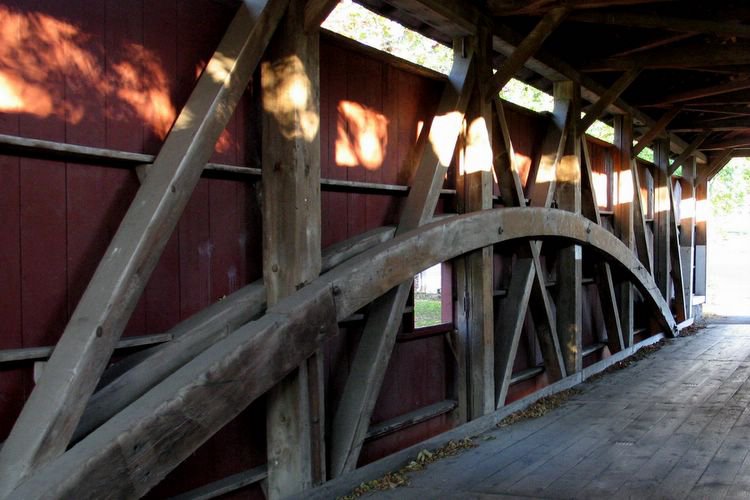
Our route took us through several of the area's famous,old covered bridges. The first bridge took us across the meandering Conestoga River. This was the Bitzen's Mill Covered Bridge. The northeast, in general, and Pennsylvania, in particular, have more covered bridges than other parts of the country. That's because the "frontier" of western Pennsylvania was where the westward expansion was proceeding early on in the history of the young United States. But there were many obstacles, not the least of which were the numerous rivers and streams that crisscrossed the area. Therefore, bridges were needed and as wood was so plenitful and resistant to the vagaries of freezing and thawing (unlike paving stones), it was the obvious material of choice and was used as the superstructure of all these new bridges. On the other hand, wood rots easily. So the early bridge builders simply covered them, thus limiting their exposure to the elements and prolonging their useful lives.


Three bike buddies at the Bitzen Mill covered bridge over the Conestoga River.


The bridges are wide enough for a horse and buggy - but not for two cars, side by side. Lancaster County has 28 covered bridges. From 1820 to 1900, 1500 covered bridges were built in Pennsylvania -- today, there are still 219 remaining!


As we drove further into the countryside, we passed farm after farm belonging to Amish or Mennonite farmers. Here, black garments freshly washed, were flapping and drying in the autumnal sunshine - a strange sight. There, a farmer cut back stalks in his field using a machine pulled by a team of horses. Later that night, lying in bed at the Best Western in Intercourse, we learned from a video on TV that there were several differences between the two sects which had been united but had split over questions of excommunication and the severe practice of shunning. The Amish, followers of Jacob Ammann, split from the Anabaptists in 1693. Ammann believed that the Mennonites were not practicing the ban or shunning as it should be. Thus, his followers are more conservative and stricter in their adherence to their separatist ways: untrimmed beards and hooks and eyes in place of buttons on outer garments of the men; horse and buggy transportation; horse-drawn implements for farming; plain and distinctive dress patterns and no electricity in homes.


A team of horses cuts back the last stalks in this Amish field.

The town of Ephrata was about 15 miles north of our starting point in Lampeter and we were tired from the contstant battle with the north wind. Then too, it was getting late - we had forgotten that the clocks had turned back an hour over the past weekend and that the sun would be setting around five. We didn't want to be on the road after dark. So we took a quick look-see at the Ephrata Cloisters but, even though it looked interesting with its ancient log buildings, decided to pass it by on this trip. We stopped for lunch on Ephrata's Main Street, lined with lovely old homes and 19th century office buildings.

It was three o'clock when we turned our attention to the rest of the ride - we would be heading south this time so the wind would be at our backs. We hoped it would speed us along. But we still had 20 miles to go and only two hours to cover it. A good pace was needed and we were sceptical of succeeding.


Beautiful old buildings on Ephrata's Main Street.


We stopped for hot soup and a sandwich at Oakley's Cafe in Ephrata - nice.


Erb's covered bridge - on our way back.


My long shadow. The sun was getting low at 4:30 and we had miles to go.


Still another bridge - the Log Cabin bridge. Note the sophisticated construction using bent timbers for strength.


The sun dips below the horizon - we were almost home.


Fred - tuckered but euphoric from the beautiful day's ride.

We had just a few miles to go when we got held up by a stalled train at a railroad crossing. Dozens of cars were waiting too. After a while, the wheels of the train groaned and it slowly pulled away. The gates opened and we pedalled away, trying to finish before the fading daylight turned to dark.


A blazing red tree set off a monochrome field outside this Amish homestead. The buggy is parked for the night.


Oh no - a stalled train delayed our return ... just a couple of miles to go but the light was rapidly fading.


Bob waves to me from an overpass - we're almost back to the car.

We made it - in the nick of time - tired but elated at the beauty of the ride we had taken. Despite the tough going and the struggle to finish before dark, I wouldn't have had it any other way - the magic of the fading light as darkness covered the fields and countryside was as beautiful a sight as you could imagine. The Times article was right in quoting Ernest Hemingway who wrote --
"You have no such accurate remembrance of a country you have driven through as you gain by riding a bicycle."

We drove to our motel and showered up before venturing out for dinner back in Ephrata. The next day we took a short ride around Intercourse - another lovely adventure with great vistas of the surrounding farmland. Then we headed back to the big city - but not before stopping in Lititz (pronounced litt'-its but pronounced by us guys, humorously, with the accent on the last syllable) for a tour of the country's first pretzel factory.


The Julius Sturgis pretzel factory in Lititz, Pennsylvania.


Fred tries his hand at rolling pretzels.


Um, Fred should probably not embark on a pretzel-rolling career.

Our trip was, simply put, a couple of days in Paradise - a glimpse into a community that lives in the past and tries to coexist with present times. Modernity intrudes all around the Amish - subdivisions and rampant commercial development have been built on pristine farmland and, what were once quiet and remote lands, are now plagued with rush hour congestion and malls. I thought to myself that it would not be long before all this was totally gone and that's a tragedy. What is the meaning of progress if it destroys the beauty and serenity of that which came before? My advice --get to see it while you still can.